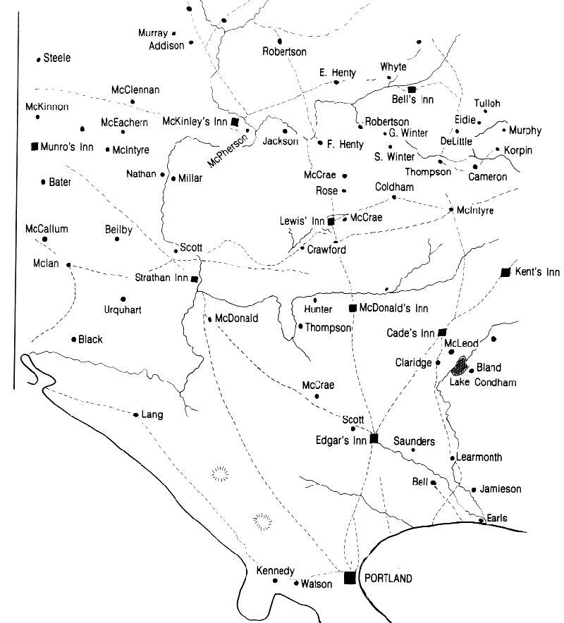
The above map is a sketch taken from the 1848 map (drawn on stone by H. LINGHAM) of South West Victoria from Wando Vale (Robertson) in the North to Portland in the South and the South Australian border in the West to Branxholme (Kent's Inn) in the east, showing Inns, Settlers and main tracks.
[Source : Merino - Digby "Heritage" 1977, copied from an 1842 [sic 1848] map.]
NOTE : A digital image of the original LINGHAM stone map can be found in the State Library of Victoria collection by using the search function on this External Link
Carapook .
Casterton .
Coleraine .
Dartmoor .
Digby .
Hotspur .
Merino & Henty .
Sandford .
Wando Vale
1848 Map ..
1885 Map ..
Regional Articles & Maps ..
Researchers ..
Links